More to See on North Skyline
By Neil Wiley · June 2026 · Volume MMXXVI, Number 6 · Page 18 · 4 min read
Skyline Boulevard is a beautiful highway serving many beautiful open-space preserves. I’m often tempted to pick one preserve along the highway, walk a few trails, and drive home. On this trip, I lived up to our title: . Not by walking off the trail, but by following my curiosity to see more along the way.
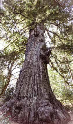
My first stop was to see an old tree. It is called Methuselah for good reason. This redwood is 1,800 years old. It is big. The trunk is 14 feet in diameter. It is also tough. The thick redwood bark shields the core. If the crown is damaged by fire, the tree can sprout new growth. It even survived loggers who cut down nearby trees.
What impressed me the most, however, were the giant roots. Visible above ground, they go deep and wide to build a strong foundation. Although Methuselah is on California Water Service Company land, you can walk around the tree on several levels.
To visit this old-growth redwood, drive about 3.3 miles north of the Highway 84 intersection and Alice’s Restaurant. Watch for a small sign on the right (east) side of the road. You can park at the south entrance to El Corte de Madera Creek Open Space Preserve.
My next stop was Skeggs Point, a few miles north on Skyline. It isn’t much of a vista point, but it provides a pleasant place to park or have lunch on the east side of the road. While there, I met a friendly family visiting El Corte De Madera Creek Open Space to see the tafoni sandstone formation. We crossed to the west side of the road and walked a short distance north
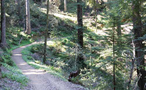
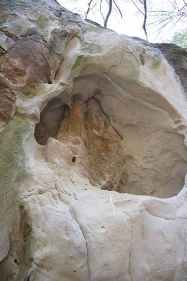
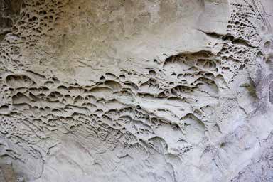
to the northern entrance of the preserve, where we collected our maps. In a few steps we were on the Tafoni Trail. It was a pleasant walk in a shaded forest with lots of curves with ups and downs in a 5.1-mile loop. (Although the preserve is a popular bicycle park, this trail is not open to bikers. Instead, they can use the smoother, more bike-friendly Both trails meet near the entrance to a narrow, rough path to the Tafoni. Named for an Italian geologist, this tafoni of eroded sandstone creates spectacular patterns. Deep, rounded, cavernous voids in the rock have been carved by exposure to the elements. Even the family’s preschooler I was impressed, too. After the family left, I took many photos, but a copy on paper doesn’t do justice to water on rock.
I walked back to my car on the Fir Trail. It was smoother and wider, but I was passed by a few fast bikers. The trail turned into a paved road with a tall tower and an unhappy barking dog. I was back in civilization. My next stop was Alice’s Restaurant at the intersection of 84 and 35 (Skyline). It is a great place to eat, especially if you have been walking, riding, or just enjoying nature. You walk up to the counter, place your order, and go out to a little park. You click a little device that tells the staff where you are. In a few minutes, a waiter is bringing you lunch.
For someone who is hungry as a wolf, this is But there was something else I explored. On a back wall next to the restaurant, I reviewed a large map of local mountain preserves and parks with descriptions. I saw many future Although I’ve been going to Alice’s for many years, I discovered a tiny store next door. I found a copy of The South Skyline Story, a 231-page book with an eight-page folded map by Janet Schwind and The Skyline Historical Society. It was copyrighted in 2014, but this book covers many periods of local history. It’s another way to learn more about the Santa Cruz Mountains.
I had enjoyed enough explorations, but as I drove south on Skyline I decided to modify my tour. Instead of driving to Black Road, I turned east on Page Mill Road to reach Highway 280. I had driven only about two miles when I saw the entrance sign for Midpen’s Monte Bello Open Space Preserve.
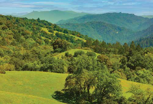
I couldn’t resist. I drove into the large parking lot at the top of a hill. Below were large green hills and deep valleys. In the far distance, I could see our own Mount Umunhum. Closer, I could see sections of the Stevens Creek Nature Trail and other trails that could lead to the 2800-foot peak Black Mountain.
There were many nice views on the way down Page Mill Road to Highway 280, but there were many curves, too. Also, my timing was bad. I reached 280 just in time for rush-hour traffic. It was only research, but I see a Monte Bello exploration in the future. Let me know if you’ve been there. You can leave me a