Walking between Rains
Local Walks
By Neil Wiley · February 2026 · Volume MMXXVI, Number 2 · Page 18 · 6 min read
Early January rains interfered with my plans for longer hikes. It was a good time to revisit interesting places where you can walk closer to home. Here are a few examples near me. Summit Trails. You can choose between two local Summit Road trails. One runs east 1.3 miles on the north side of Summit Road.
It starts across the road from the eastern entrance to the Villa del Monte subdivision, and extends to Loma Prieta Avenue and Summit Store. The other trail goes west 1.4 miles from Del Monte Way along the south side to Old Summit Road.
The two trails have much in common. They are narrow, poorly maintained, and a bit close to Summit Road traffic. On the other hand (or foot), they are centrally located and safer than walking or riding on Summit Road. At the very least they offer good exercise outside.
Summit Road to Summit Store. The trail east to Loma Prieta Avenue takes you past Timmus Lane (Summit spelled backward). It also passes Morrill Road, a lightly traveled one- mile loop through deep forest behind the Loma Prieta Playfield. (This loop offers a great shady detour, especially in summer. It ends back on Summit Road.) Note that on the Santa Cruz side of the road, Morrill becomes Morrell. (Santa Cruz is right. H.C. Morrell bought his home on the Summit in 1867. His wife was Clarissa Burrell, daughter of Lyman Burrell, a pioneer often recognized as the first permanent resident of the Summit area.) The Summit Trail continues past our local schools and a big Christmas tree farm. The farm is private property, but hikers and dog walkers enjoy the views toward the ocean, rows of Christmas trees, and open space. (To protect public use, be sure to clean up after your dog.) Across Summit from the schools, the big grassy area of the Loma Prieta Playfield is a public place to walk. As a bonus, you can find shade and a short loop trail through the redwoods behind the field.
Continuing along Summit, you’ll pass Mountain Bible Church and Pippa’s home and gardens, the site of many wonderful folk-music concerts. As we pass by the schools, the trail widens near the Burrell School and Regale wineries. Looking north, we see the mountain ridges of Sierra Azul Open Space, including Mt. El Sombroso (2999 feet), Mt. Thayer (3483 feet), and Mt.
Umunhum (3486 feet). These mountains may become more accessible when they can be entered from our side of the mountains. Looking to the east reveals the mountain Loma Prieta. The towers at the peak are inaccessible and the road is rough, but the views are worth a drive up Loma Prieta Way.
The Summit trail passes Loma Prieta Avenue and on to Summit Store, a good place to rest in the shaded patio while enjoying snacks and drinks. Summit Road to Old Summit Road.The Santa Cruz version of the Summit Trail begins as a wide path at the northern edge of Villa del Monte. You cross Sunset Drive across the road from Summit Veterinary Hospital, then walk by two churches. The first section from Villa del Monte to Old Santa Cruz Highway is too close to the road and often disappears, but the views are interesting, including a little free library, a seasonal duck pond, and flocks of birds in a large green grass field.
Further west, you continue past Trail Ridge, the road to the beautiful gardens of Maison du Lac. If you are hungry, stop by the Mason- Taylor Ranch, home of fresh mountain produce. The next section from Old Santa Cruz Highway to Old Summit Road is in better condition and easy to follow. Some of the road is paved. Other sections are packed dirt, When you reach Old Summit Road, you can follow it all the way to Highway 17.
Trail history. According to Marlene Wiley’s Summit Pathway story in the May 1997 issue in MNN, “Ed Lopez and Dick Stebbins graded the path east from Villa del Monte to Loma Prieta Avenue in 1969. Santa Clara County did the oiling. In the early 1970s, the Patchen 4-H Club cleared a path from near the old Pheasant Farm on Old Summit Road eastward almost to Old In early 1992, Mike Hart, a member of the Loma Prieta Community Foundation and an enthusiastic community builder, began a campaign to construct an all-weather, multi- purpose trail. His drive, combined with the support of Santa Cruz County Supervisor Jan Beautz, resulted in the dedication of the Summit Pathway on October 18, 1997.
As reported in the November 1997 issue of MNN, “Speakers included Teall Messer, acting planning commissioner, Santa Cruz County, Leslie Meehan, president of the Loma Prieta Community Foundation, Scott Salsbury; Loma Prieta school board member, and Mike Hart; the community activist who successfully campaigned for the new trail. Neil Wiley served as the master of ceremonies and provided the appropriate food for the occasion—trail mix. Everyone thanked Mike Hart for his persistence, Supervisor Jan Beautz for her support, and Santa Cruz County for funding.”
Unfortunately, Mike Hart left our area to run several railroads. Although these trails still serve our community, both could be improved. Hopefully, someone with the enthusiasm and drive of Mike Hart will further improve the trails along the main road in the Summit area. Our community could enjoy better multi-use trails.
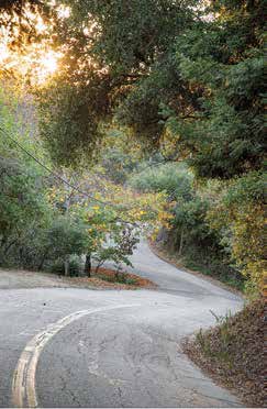
The Villa del Monte Loop. If you want more exercise in a short distance, try walking the Villa del Monte loop. It has some ups and downs, but you are walking on pavement. Over the years, I’ve walked the loop with packs of dogs, including some belonging to my neighbors. Now, dogs are on leash, which is less free but safer.
We had horses. Many years ago, 17 horses were stabled in the Villa. No horses are here now. (We have fewer riders and fewer flies.) Instead, we have more cars driven faster. Although walkers (and drivers) need to be more careful, it’s still a good experience to walk in a mountain neighborhood, meet neighbors, and enjoy the outdoors.
To reach the Villa Loop from Highway 17, follow Summit Road east from Highway 17. After passing churches on both sides of Summit, watch for the Summit Vet building across from the first of two Villa entrances. You pass the water tank and continue downhill around a long curving road. You pass BelAire Court and follow downhill around two curves to reach the bottom of the loop, then continue on Skyview Terrace.
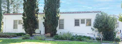
You might want to make a few rest stops on the way, perhaps one at the very lowest point where you can find a curb for sitting, and sometimes hear some waterfalls, After a rest, you walk up the hill around a few curves. After passing Skyview Court on the right, you take the next right on Cove Lane. After a short distance, you pass the road to the left and continue uphill. On the right, you can see the original Villa del Monte estate. When you reach Evergreen, turn left and continue past the loop starting point on Skyview Terrace. When you reach the cross street of Sunset, you can turn Ask a neighbor. There are many other roads and trails you can walk in our mountains. Ask a local from Redwood Estates, Skyland, Hutchinson Road, Aldercroft Heights, Old Santa Cruz Highway, Redwood Lodge, Schulties Road, or other mountain neighborhood. You may discover a special place to explore outside.
If you do, perhaps you can share your