
Lake Canyon Centennial
Hidden Gem in the Mountains
By Bud Everts · November 2026 · Volume MMXXVI, Number 11
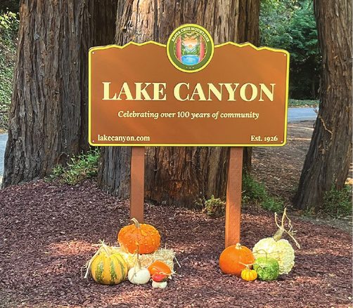
Nestled in the forest south of Los Gatos and west of Lexington Reservoir, the mountain community of Lake Canyon is defined by its dramatic topography. It features towering second-growth redwoods, steep Douglas fir slopes, and perennial mountain springs.
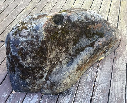
Long before the 1900’s, this canyon served as a rich ecological corridor and home for Indigenous people. The Ohlone people ground acorns into a fine meal or flour to serve as primary staples. Several rocks in the community still show indentations used for that purpose.
Lake Canyon is just west of Highway 17, between Black Road and Montevina Road, up the canyon that runs above the small sliver of Lexington Reservoir on your right as you drive toward Santa Cruz. Many visitors are surprised to find this beautiful and quiet community of 56 homes tucked into the forest, just a six-minute drive to downtown Los Gatos.
Beardsley Road is the main road in our Canyon. It runs along Lyndon Canyon Creek, and gets its name from the Beardsley family. They were prominent early settlers and landowners in Santa Clara County and the Santa Cruz Mountains during the late 19th and early 20th centuries.
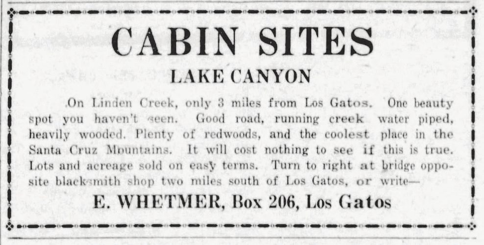
The Weekend Escape Boom. In the mid-1920s, improved automobile access and a yearning for fresh mountain air triggered a land rush. Families from San Jose and the broader Bay Area bought small parcels along the canyons to build rustic summer cabins, which were later transformed into permanent homes.
Self-reliance, volunteering, and resilience have been enduring qualities of Lake Canyon residents. We manage our roads, secure our own water, and look out for one another through storms, floods, landslides, earthquakes, droughts, and wildfires.
Self-Reliance. Before Lake Canyon was officially subdivided into a residential community on July 25, 1926, the canyon was part of larger mountain homesteads and logging territories. Lake Canyon had a weigh station and market for loggers to weigh their logs and stock up on supplies. There was a community room and movie house. Ranchers and homesteaders in the area carved out dirt wagon trails to haul timber and access the valley below. The primary route snaking through the canyon took the name of the Beardsley family homestead that it originally passed through. When the community was formalized in 1926, the historic name was retained and the road was paved to serve the canyon’s properties.
While the subdivision was officially mapped out in 1926 as a weekend escape, and as housing for loggers and miners, the permanent growth of the neighborhood required disciplined infrastructure management.
In 1938, property owners formally incorporated the Lake Canyon Mutual Water Company. As a private, nonprofit mutual water company, the members established the company to capture, treat, and distribute clean drinking water across the steep terrain of the canyon while maintaining the private mountain roads we depend on every day.
Running a water system in the Santa Cruz Mountains is no small feat. Over the decades, generations of board members, treasurers, and operations managers have balanced state compliance, seasonal weather shifts, watershed protection, and system upgrades. From early gravity-fed spring boxes to modern treatment operations, the water company has weathered droughts, storms, and regulatory evolutions without losing its grassroots spirit.
For about nine months of the year, our water comes from a mountain spring, providing high-quality water that requires minimal filtration. During the dry fall months, our supplementary source is Lyndon
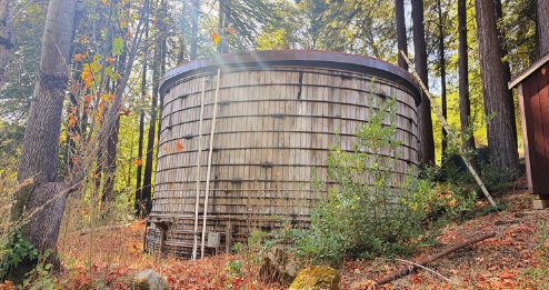
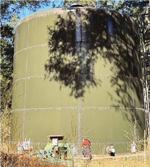
Canyon Creek, with headwaters at Lake Ranch reservoir near Sanborn-Skyline Park.
Our residents are frugal with their water use, and our water company continues to roll out high-tech meters to immediately detect residential water leaks so they can be repaired quickly.
In 1993, the Lake Canyon Community Services District was established as an independent special district. It was created after the Santa Clara County Health Department found widespread inadequacies with individual on-site septic systems, prompting the creation of a centralized community network for wastewater treatment.
Roads. When Highway 17 was completed in 1940, it replaced the winding, narrow stagecoach routes and bypassed the declining railway. It solidified the automobile as the primary way mountain residents commuted to the valley or coast.
In the late 1940s and early 1950s, booming population growth in Silicon Valley triggered a severe water deficit, requiring the Santa Clara Valley Water District to capture runoff from Los Gatos Creek. The James J. Lenihan Dam and Lexington Reservoir reshaped the infrastructure of the Santa Cruz Mountains south of Los Gatos.
The construction of the 195-foot-high earthen dam began in the spring of 1952. The resulting Lexington Reservoir completely submerged the historic 19th-century logging and stagecoach towns of Alma and Lexington. Because the new reservoir body would fill the deep mountain basin, all existing low-lying infrastructure— including local mountain roads and State Route 17—were rerouted to higher ground.
Prior to the dam’s construction, Beardsley Road ran lower along the canyon basin floor, connecting Lake Canyon to old thoroughfares along Los Gatos Creek.
Engineering surveys showed that once the Lenihan Dam was completed and the reservoir reached its maximum capacity, the original alignment of Beardsley Road would be permanently underwater, cutting off access to the properties nestled in the western canyon arm.
To maintain access for residents on the west side of the canyon, the road was re-engineered. It was pushed significantly upward and northward along the steep hillside slopes.
The relocated Beardsley Road was carved into the ridge to hug the newly formed western arm of the reservoir and mapped out to function as a crucial connector high above the waterline, starting from Montevina Road in the north and weaving south toward Black Road. Today, Beardsley Road sits safely above the flooded ruins of the old ghost towns drowned by the 1952 project. Besides Beardsley, the other four roads in Lake Canyon are named after local foliage: Laurel, Oak, Madrone, and Manzanita.
The overpass at Bear Creek Road and Highway 17, officially named the Gillian Cichowski Memorial Overcrossing Bridge, was built in 1996, replacing the dangerous at-grade intersection with a safer grade-separated overcrossing.
Resilient Residents. Due to its steep, mountainous terrain and proximity to major fault lines, our community’s history has been shaped by regional earthquakes, landslides, and floods. Here are some of the significant geological and hydrological events that have impacted the Lake Canyon area.
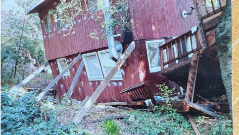
Earthquakes. The 1989 Loma Prieta Earthquake was the most disruptive seismic event to hit the region since the community’s founding. Centered just 13 miles “as the crow flies” from Lake Canyon, the violent shaking caused widespread structural damage, ruptured local propane lines, and triggered landslides throughout the surrounding canyons. Our community sits near the complex San Andreas Fault system. Regular low-to-moderate regional tremors frequently rattle the canyon, requiring extra precautions for our underground water-main infrastructure integrity.
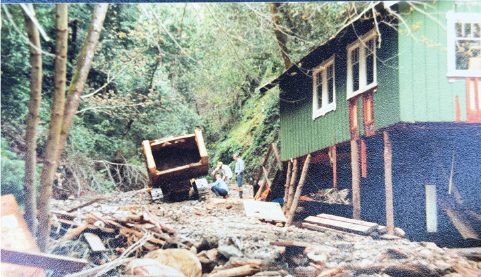
Landslides. Land movement is a persistent threat. The combination of steep slopes and saturated soil during storms sometimes causes localized slope failures. Heavy mud and rock movement on uphill county lands may wash down into the canyon, impacting local bridges, roads, and drainage culverts during severe winter weather.
The historic California floods of 1955, 1982, 1997, and consecutive recent atmospheric rivers bring heavy rainfall to the mountains. Intense downpours can cause rapid rises in Lyndon Canyon Creek (also known as Beardsley Creek), which serves as a secondary water source for the Lake Canyon Mutual Water Company. These flash-flood conditions wash heavy debris down the mountain washes.
Traditions. Several families have lived in Lake Canyon for three generations, including the Cabral, Abbott, and Snetsinger families. Jack Cabral settled here in 1959 and served as president of our water company for 25 years. Jack built one of our bridges and our redwood water tank, and upgraded our water system.
His daughter Rebecca continues that tradition of volunteering today as our current president. Rebecca organizes many annual events, including an Oktoberfest potluck, Halloween boos cruise, friendsgiving dinner, and our holiday-lights competition and celebration.
We recently held volunteer creek cleanup weekends to prepare for the super El Niño forecast this winter. Our Firewise Committee has received and maintained official recognition of Lake Canyon as a Firewise USA® community by improving our wildfire resilience, increasing awareness of fire prevention, and educating the community. We hold an annual emergency-evacuation drill with the support of the Santa Clara County Fire Department.
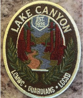
We recently upgraded our website, created Centennial Commemorative Patches for our community members, installed a new welcome sign at our canyon entrance, and celebrated our 100-year anniversary at our annual meeting in October.
We certainly enjoy, and are thankful for, the beauty, peace, and neighborly feel of our “Hidden Gem in the Mountains.”
See it on printed page 14 of November 2026 · Volume MMXXVI, Number 11 →