More than open space
Purisima Creek Redwoods
By Neil Wiley · May 2026 · Volume MMXXVI, Number 5 · Page 18 · 3 min read
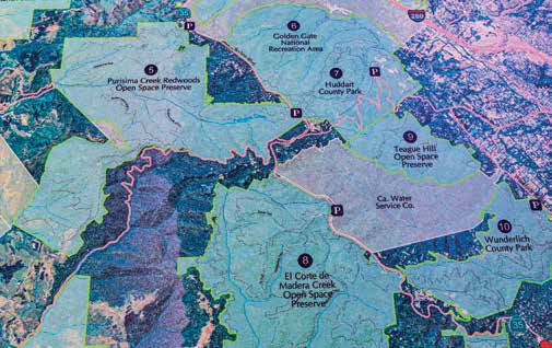
One hour’s drive from our mountains takes you to Midpen’s Purisima Creek Redwoods’ 24 miles of trail. I think you’ll find it worth the trip. It is a scenic adventure. Your journey begins with a short drive north on Highway 17, but it gets better. You turn up Black Road. It is narrow with lots of curves, and as you near the top, no matter how slow you go, you think you are going too fast. Reaching Skyline Boulevard (Highway 35) is a joyful achievement. (You could go via Saratoga’s Highway 9, but you would miss a beautiful section of Skyline Boulevard, including Castle Rock State Park.) Many of Midpen’s 27 preserves are accessible from Skyline. You can review them all on-line at Midpen’s openspace.org.
North Ridge Parking is at the very end of this preserve parade. It offers 41 car spaces and 23 ADA slots. It is conveniently located near the North Ridge Trailhead and access to the Wittemore Gulch and Harkins Ridge trails. You can see the parking lot on the left side of Highway 35 about eight miles from the intersection with Highway 84 and Alice’s Restaurant.
Redwood Roadside Parking is available near the Purisima’s Redwood Trailhead, about six miles from Highway 84 and Alice’s Restaurant. It has only 11 spaces and two ADA slots. If you can find a space, this is a good place to park while visiting the Redwood Trail. This trail has a several tables along a shady path. It is a good place for a short walk or picnic, but if you want to see
more scenery the north entrance offers more located on the ocean side of the preserve. Unfortunately, it has only seven spaces and one ADA slot. I parked there once to meet up with a group of photographers. Although we enjoyed taking nature photos in a cool, shady environment, parking was difficult.
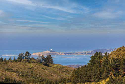
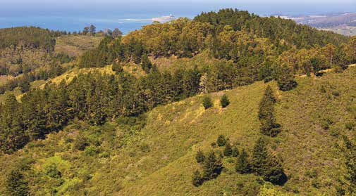
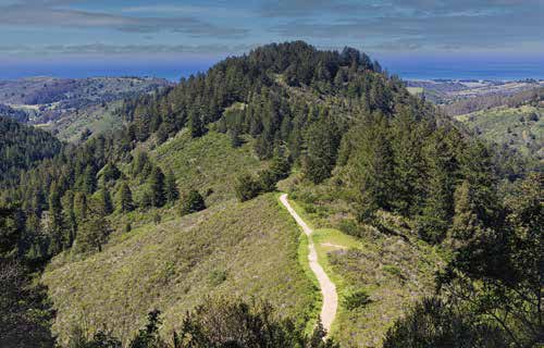
From this entrance, you can take the Whittemore Gulch or Harkins Ridge trails to North Ridge, or the Purisima Creek Trail across the entire preserve to the Redwood The North Ridge Trail offers more variety with tall trees, green meadows, and sunny views of mountains, a huge valley, the ocean, and big skies. Although it is a dead-end trail, it offers dramatic views while avoiding long, If you like variety, you can turn at a crossing from North Ridge to Whittemore Gulch. (Turn at the fence.) This trail takes you all the way to the park’s west end near the ocean. It is a long trail with interesting For my trip, I enjoyed the North Ridge Trail. When I reached my perch on a North Ridge cliff, I saw across the valley to miles of beautiful scenery. It was spectacular!
The experience gave me a lift so I took the Chris Macintosh Trail back to the parking area. It runs parallel to North Ridge, is a little longer, but displays a few extra views, more climbs. and lots of curves. The best part was that I could look down on my fellow hikers.
Good news. Midpen is planning a segment of a 40-mile trail that will link the California Coast Trail and the Bay Area Ridge Trail. If you like walking, you could travel from the Pacific Ocean over ridges, through canyons, under shady forests, to the Santa Cruz More open space preserves north of Highway 84